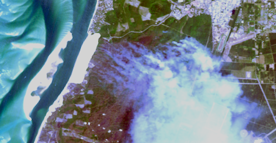
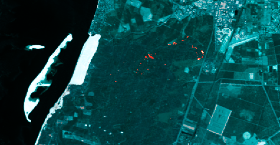
The smoke from the fires blocks the view of the Earth surface in the visible bands (see Image 1), but the infrared bands of EnMAP partially look through the smoke (see Image 2). And thanks to the high radiometric resolution of the sensor, the forest fire hotspots may be seen in the infrared bands, and the signal sensed can be used to estimate the temperature of the fire hotspots.
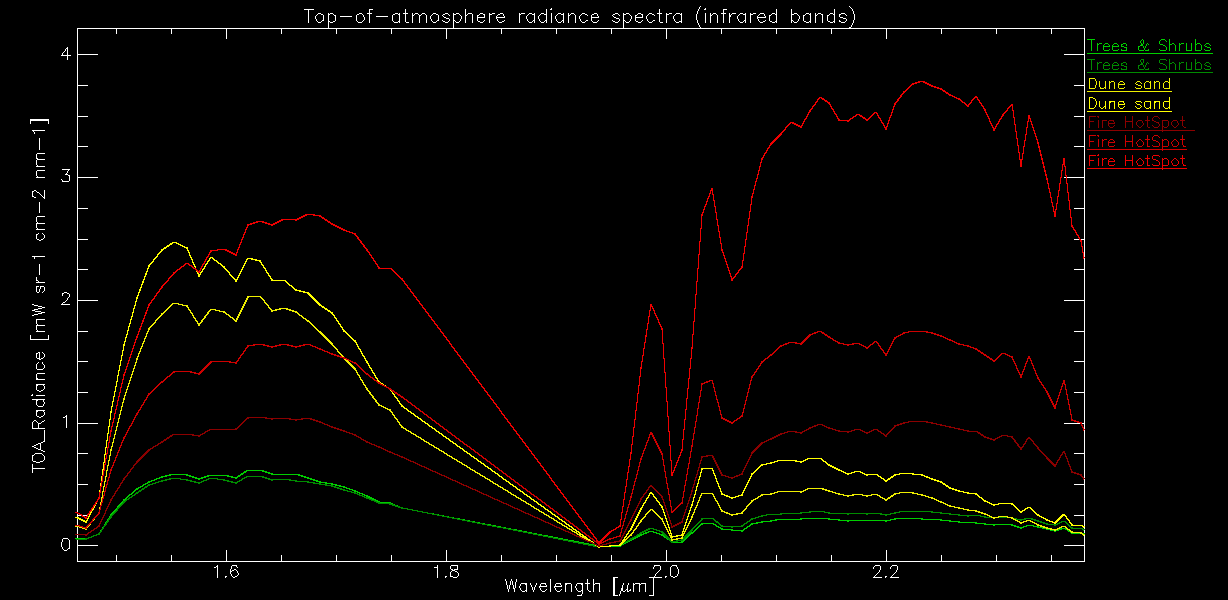
The physical principle is that for a normal Earth surface like the vegetation and sand spots, the reflected radiation from the surface is sensed. For areas with larger active fires, (additional) radiation is emitted by the fire adding to the reflected radiation (see Image 3). As described by the Planck's law, this emitted radiance is a function of the temperature. Normally, sensors covering the thermal wavelength range are used for fire detection and temperature retrieval, but for high temperature fires, these effects can be sensed and quantified by the infrared bands of EnMAP.