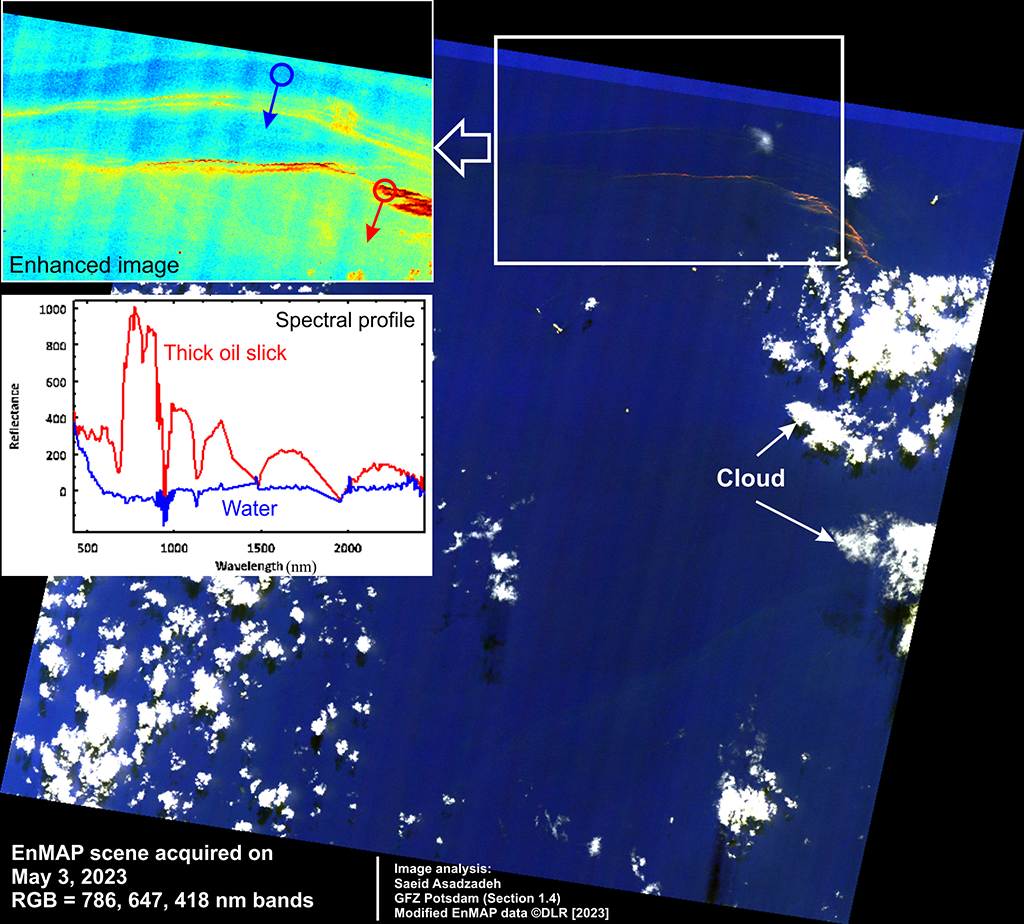
The Environmental EnMAP satellite successfully captured data over portions of the oil slicks, marking the first time this has been achieved by the instrument. Preliminary spectral processing indicated that EnMAP hyperspectral data can detect oil slicks and differentiate between different oil thicknesses thanks to its high spectral resolution and high signal-to-noise ratio, as shown in the main figure. In color composite imagery, thick oil slicks (emulsions) are depicted by orange color whereas the thinner oil slicks display similar but fainted colors over the dark blue color of the ocean. The enhanced pseudocolor imagery (top left map) shows a spectrum of thickness, ranging from a vibrant red representing a thicker oil slick to a green shade representing a thinner slick, with the background ocean depicted in blue. The differences in the colors correspond to meaningful variations in the spectral profiles retrieved by the EnMAP reflectance data (bottom left figure). The capability of spaceborne hyperspectral data to effectively detect and characterize oil slicks holds significant potential for enhancing global monitoring systems and providing early warnings for oil spill accidents. This report contains modified EnMAP data © DLR [2023].