End of May 2023, the United Nations Institute for Training and Research (UNITAR) on behalf of the Food and Agriculture Organization of the United Nations (FAO) activated the International Charter "Space and Major Disasters", which is an association of space agencies and satellite operators with the aim of providing a unified system for the rapid acquisition and delivery of satellite data in disaster or crisis situations.
DLR officially joined the Charter in 2010 and provides free availability of data of national satellite missions as well as rapid mapping products to authorized users, such as relief and civil protection organisations or defence and security organisations, to support relief operations in the event of humanitarian or natural disasters. Since 2010, DLR provided at about 3,300 data for 460 Charter activations in more than 100 countries.
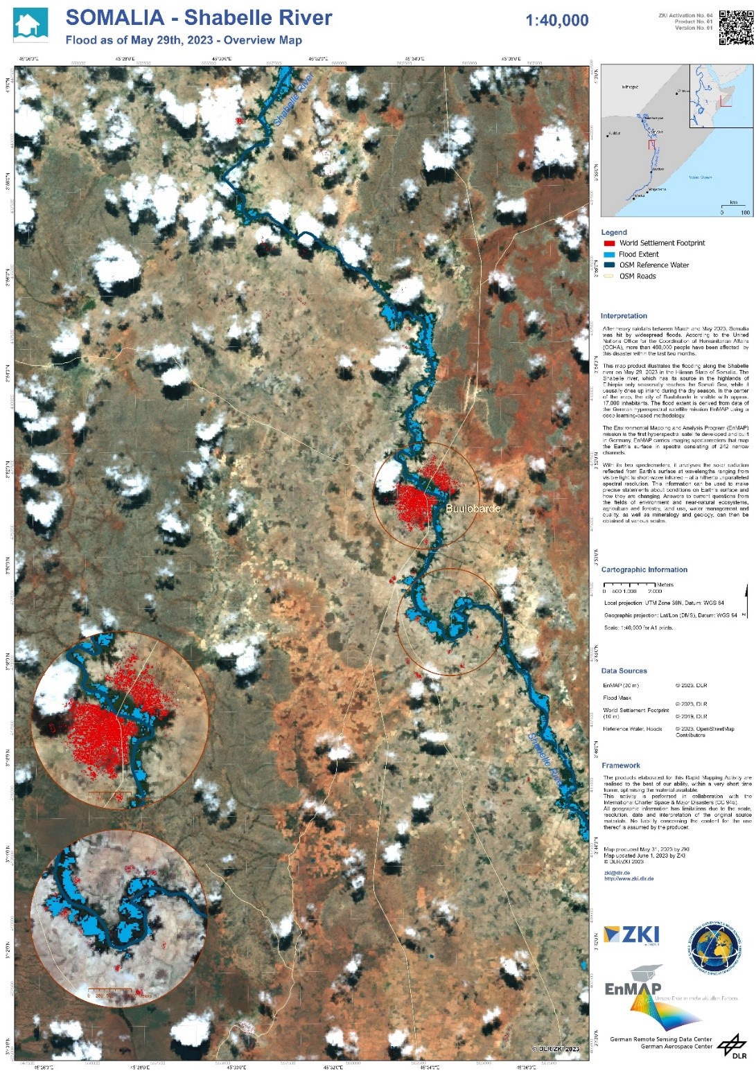
For the flood event in Somalia, the Center for Satellite-based Crisis information (ZKI) of DLR performed for the first time the rapid mapping based on data of the German hyperspectral satellite mission EnMAP in the frame of the Charter (ZKI Activation ACT158).
Fig. 1 shows a map product, which illustrates the flooding along the Shebelle river in Somalia on May 29, 2023 in the Hiiran State of Somalia. The Shabelle river, which has its source in the highlands of Ethiopia, only seasonally reaches the Somali Sea, while it usually dries up during the dry season. In the Center of the map, the city of Buulobarde is visible. The flood extent is automatically derived from EnMAP data using a deep learning-based methodology. EnMAP data serve as backdrop of the map.
In future, EnMAP will also be able to provide valuable information in other crisis situations, e.g. about water pollution, oil slicks, marine plastics and other contaminants in the water and on land.