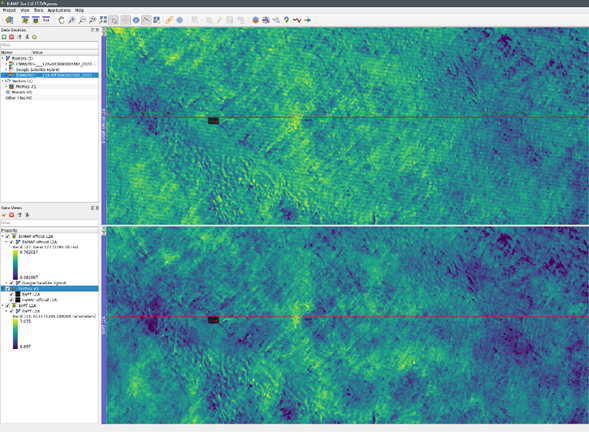
Within the EnMAP SWIR data, along-track (horizontal) striping can be present in some scenes in certain SWIR bands, see FAQ document, chapter 5.15 for a detailed description of the effect. EnMAP users that would like to correct for this effect, mostly seen in the wavelengths close to the water bands, can now use an available tool online. The EnPT version 1.4.0 (GUI-Version 1.2.0), released on 17.06.2026, features an along-track destriping approach developed at GFZ for the corrections of the horizontal stripes.
This correction is to be applied on EnMAP L1B products at the user’s discretion. Although the correction can effectively remove along-track striping, it may introduce other artefacts. Users should therefore evaluate the results on a scene-by-scene basis. In particular, artefacts may occur in image rows containing both land and water surfaces.
To access this correction, users need to update the two packages enpt and enpt_enmapboxapp to the version 1.4.0 and 1.2.0, respectively. Further, within the EnMAP-BoxQGIS PLugin, the graphical user interface of EnPT can be accessed via the applications menu > EnPT (EnMAP Processing Tool).
Related Links:
- Git repository: EnPT - EnMAP Processing Tool
- Documentation: EnPT Python | Along-track destriping