
The extreme heat and dry conditions experienced across Europe in summer 2026 have led to numerous wildfires. EnMAP data can be used to assess fire severity to characterize the damage caused by these fires.
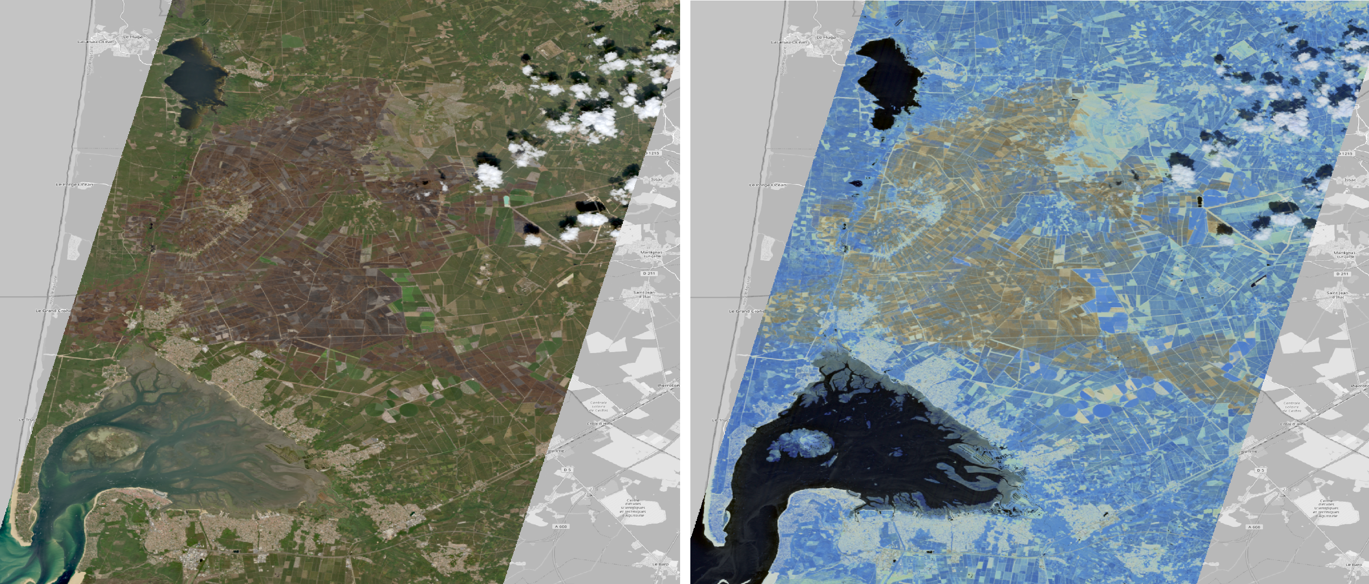
As an example, the EnMAP image below is centered on Le Porge, near Bordeaux, France, and shows an area affected by a wildfire. The image (date 11.08.2026) shows an area of approximately 30 km by 50 km in the VNIR range on the left (bands R=635 nm, G=551 nm, B= 464 nm ) and in the SWIR range on the right (bands R=2199 nm, G=1653 nm, B=1048 nm).
More information on the wildfire situation in Europe is available on the EU-JRC website.