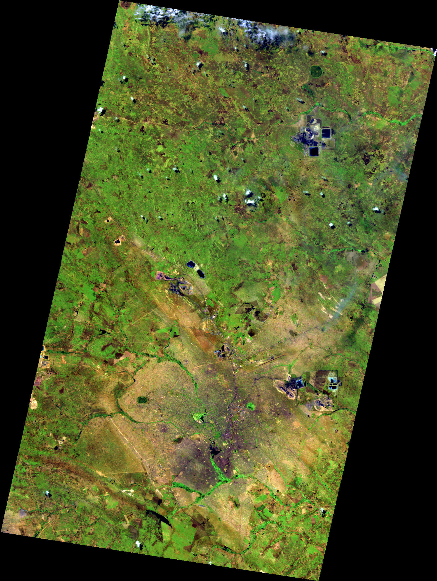
This EnMAP false-colour image shows Lubumbashi, the second-largest city of the Democratic Republic of the Congo, close to the Zambian border. In this band combination, vegetation appears green, while the urban area, with its regular street grid, appears in beige, brown and violet tones. East of the city centre, the open pits, waste dumps and process ponds of the Ruashi and Étoile copper–cobalt mines are clearly visible, with further mining sites to the north-west and north-east of the scene. Narrow green bands of riparian vegetation follow the river network through the surrounding landscape. The region is part of the Central African Copperbelt, where copper and cobalt have been mined for more than a century. Hyperspectral data such as EnMAP can support the mapping of exposed surfaces in mining areas and the monitoring of land-cover change over time.
Location: 27d28'31.70''E, 11d31' 9.72''S
2026/10/01, Band Combination: 151-108-28 = 1620nm - 1070nm - 550nm -- DT0000219803